
Tracking Sulawesi’s Active Faults : New Sulawesi Low-Cost GNSS Network Measures Crustal Movement
Makassar, 2 September - 19 September 2026 – Eleven new low-cost GNSS stations established through collaboration among Universitas Hasanuddin, the Earth Observatory of Singapore at NTU Singapore, and Geospatial Information Agency of Indonesia will provide continuous observations of crustal deformation along the Matano and Poso fault systems.
Across the active fault zones of Central and eastern Sulawesi, 11 new low-cost Global Navigation Satellite System (GNSS) stations are now continuously tracking the movement of the Earth’s crust at the millimetre scale. Installed between 9 and 19 September 2026, the stations form the Sulawesi GNSS Network Observation (SuNeO), a collaborative geodetic observation network established by Universitas Hasanuddin (UNHAS), the Earth Observatory of Singapore at Nanyang Technological University, Singapore (EOS–NTU Singapore), and Geospatial Information Agency of Indonesia (Badan Informasi Geospasial, BIG).
The network extends from East Luwu in South Sulawesi through Morowali and North Morowali to Poso in Central Sulawesi, providing new observations across two major active fault systems: the Matano and Poso faults. Together with eight existing BIG Continuously Operating Reference Stations (CORS), the 11 SuNeO stations provide denser geodetic coverage across this tectonically active region.
Sulawesi lies within one of Indonesia’s most tectonically complex regions, where deformation is distributed across several major active fault systems. The 2018 Palu earthquake and tsunami, together with the earthquakes around Poso in July 2025, highlight the importance of improving observations of active crustal deformation across the island.
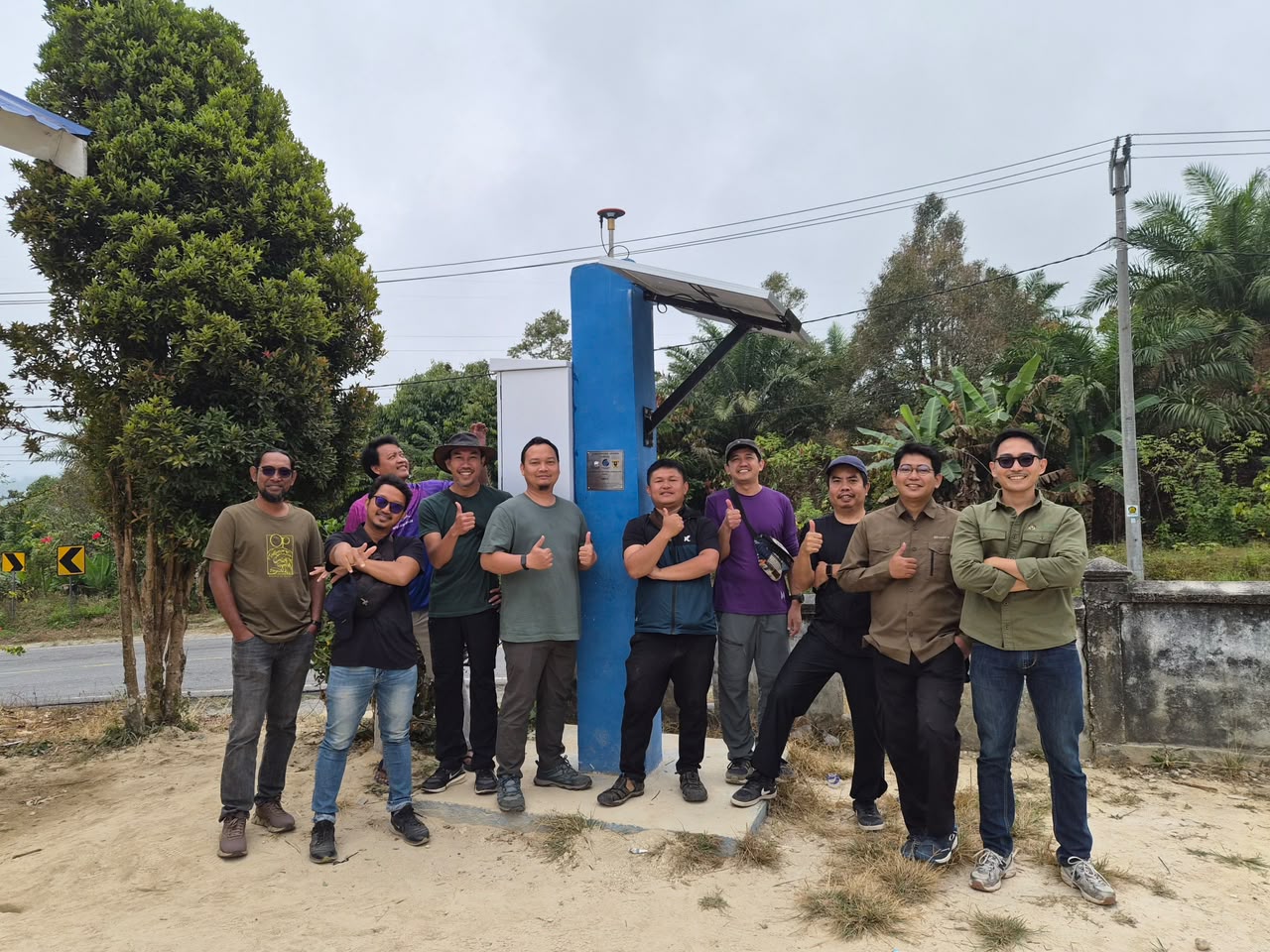
While the Palu–Koro Fault has received substantial scientific attention, the Matano and Poso fault systems remain comparatively less instrumented. SuNeO was developed to help address this observational gap. The 11 stations are located at Karebbe, Kalosi, and Mahalona in East Luwu; Siumbatu in Morowali; Tinompo and Lanumor in North Morowali; and Singkona, Taripa, Panjo, Meko, and Wataumeta in Poso. Each SuNeO station uses an affordable, yet reliable, low-cost GNSS receiver and antenna, supported by a locally fabricated monument, power system, communications, and other accessories for continuous operation. The network follows the project concept of using low-cost GNSS technology to make dense, long-term tectonic monitoring more scalable and sustainable. By measuring changes in station positions over time, researchers can investigate crustal velocities, fault kinematics, deformation patterns, and tectonic strain accumulation across the Matano and Poso fault systems. The resulting observations are expected to provide new scientific constraints on Sulawesi’s active tectonics and contribute to the scientific basis for earthquake hazard assessment.
Installing the network required an intensive 10-day field campaign across four regencies. SuNeO stations were established at locations including schools, village offices, health posts, and other local facilities, placing the observations close to communities living along the active fault systems. This distributed approach provides suitable locations for long-term observations while encouraging local involvement in maintaining the stations and strengthening awareness of scientific efforts to understand Sulawesi’s active tectonics.
“SuNeO brings together researchers and institutions with complementary expertise to address an important observational gap in one of Indonesia’s most tectonically active regions. By observing how the crust moves and how strain accumulates along the Matano and Poso fault systems, we hope to strengthen the scientific basis for earthquake hazard assessment and, ultimately, contribute to greater disaster resilience for communities across Sulawesi.” — Dr. Muhammad Taufiq Rafie, Universitas Hasanuddin
SuNeO grew from the UNHAS–EOS research project “Build a low-cost GNSS network to study tectonic deformation in Sulawesi,” together with collaboration with BIG. The project combines expertise in geophysics, GNSS geodesy, active tectonics, regional geology, low-cost instrumentation, data processing, and Indonesia’s national geospatial reference infrastructure. The September installation campaign involved Dr. Muhammad Taufiq Rafie and Aswar Syafnur, M.Eng. from UNHAS; Iwan Hermawan, PhD, Jeffrey Avila Encillo, B.Eng., Pyae Sone Aung, M.Eng., and Sandy Tri Gustono, a PhD student, from the EOS–NTU team; and Sidik Tri Wibowo, U. Samuel Sebastian Hutapea, and Ega G. Hafiz from BIG’s Directorate of Geospatial Reference Systems. The field campaign was also supported by Hafidz Ali. UNHAS contributes regional geophysical and tectonic expertise, field coordination, local partnerships, scientific interpretation, and engagement with Indonesian researchers and students. EOS–NTU Singapore contributes expertise in GNSS geodesy, low-cost GNSS hardware and software development, instrumentation, tectonic deformation analysis, data processing, research, and training. BIG contributes national geodetic expertise and provides an important link with Indonesia’s existing CORS and geospatial reference infrastructure.
“The value of SuNeO goes beyond the instruments themselves. What we are building is a long-term observational capability and a scientific partnership. As the GNSS time series grow, these stations will allow us to see how deformation evolves across the Matano and Poso fault systems, while also creating opportunities for Indonesian and Singaporean researchers and students to work together and develop the next generation of geodetic research in the region.” — Iwan Hermawan, PhD., EOS–NTU Singapore.
The low-cost SuNeO stations strengthen geodetic observations within Indonesia’s broader national geodetic control framework. At each site, the GNSS antenna is installed on a stable monument and connected to supporting equipment for continuous data acquisition, power, and communication. Combining observations from the 11 SuNeO stations with existing BIG CORS sites will enable researchers to examine deformation over a broader spatial scale. This is particularly important in Sulawesi, where tectonic deformation is distributed across multiple active fault systems.
What comes next? With the 11 stations now installed, the next phase of SuNeO will focus on continuous observation, station maintenance, data quality assessment, and analysis of the growing GNSS time series. As longer time series become available, researchers expect to obtain increasingly robust estimates of crustal velocities and deformation across the Matano and Poso fault systems. The GNSS measurements can also be integrated with seismological, geological, and other geophysical observations to develop a more comprehensive understanding of active deformation in Sulawesi. Beyond its immediate scientific objectives, SuNeO will provide a platform for joint research, student training, knowledge exchange, and capacity building between Indonesia and Singapore. In the longer term, the partners envision the network as a foundation for expanding continuous geodetic observations to other active fault systems across Sulawesi. By recording movements that may amount to only a few millimetres over time, SuNeO will help researchers build a clearer picture of how Sulawesi is deforming and provide new scientific information for understanding earthquake hazards faced by communities living along its active faults.